
Cultivating the Map
Liberal, KS (T33S - R32W - 6TH PM)
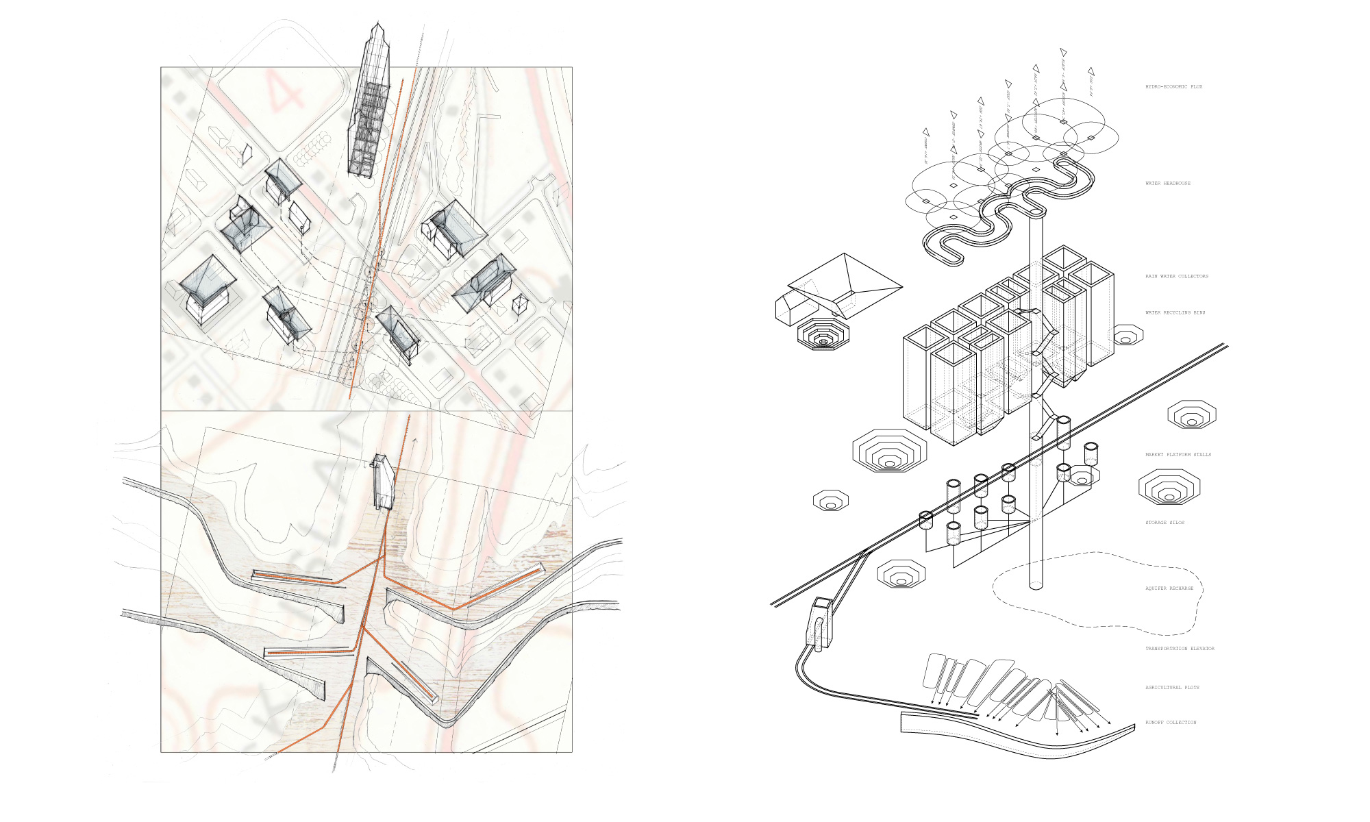
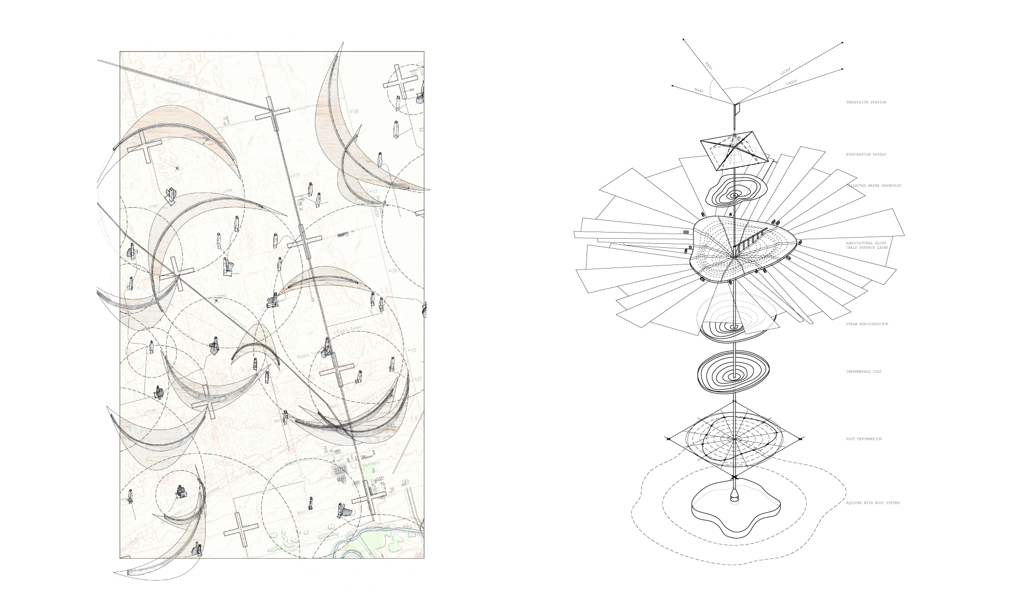
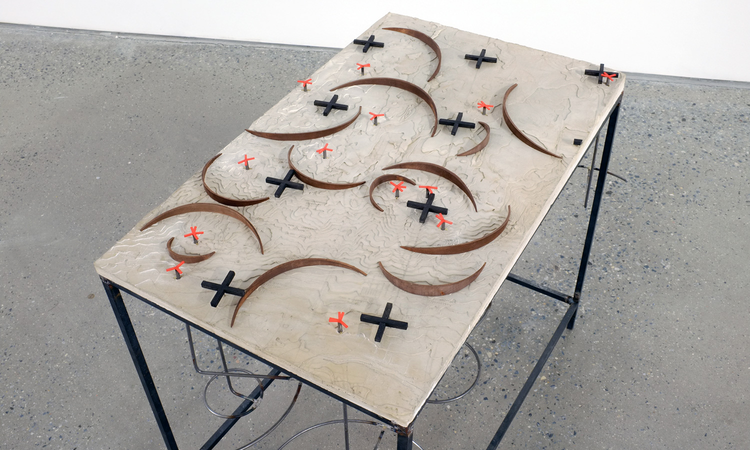
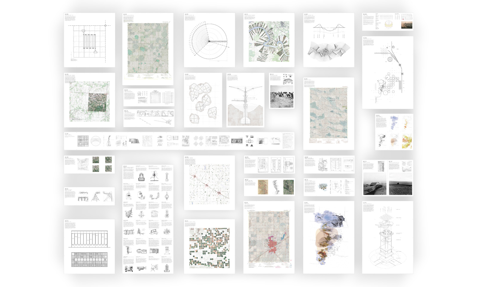
The way we live leaves traces on the Earth. The tools we use to situate ourselves in the landscape leave marks and inscriptions of these processes on the ground, becoming a direct reflection of the society that formed it. The map acts a record of these inscriptions; is an outcome of a gathering of elements for the construction of a narrative about the site’s reality. This thesis finds itself in the territory of the map, proposing that the map is also a generative tool. Using the drawing as fertile ground, this thesis attempts a predictive organization of territory through the design of four new tools for the management of natural resources in the Great Plains, a region threatened with the cumulative adverse effects of industrial farming. Each tool proposes new ways of drawing the land and acts as an instrument that reveals the landscape’s new potential.
Liberal, KS (T33S - R32W - 6TH PM)
The way we live leaves traces on the Earth. The tools we use to situate ourselves in the landscape leave marks and inscriptions of these processes on the ground, becoming a direct reflection of the society that formed it. The map acts a record of these inscriptions; is an outcome of a gathering of elements for the construction of a narrative about the site’s reality. This thesis finds itself in the territory of the map, proposing that the map is also a generative tool. Using the drawing as fertile ground, this thesis attempts a predictive organization of territory through the design of four new tools for the management of natural resources in the Great Plains, a region threatened with the cumulative adverse effects of industrial farming. Each tool proposes new ways of drawing the land and acts as an instrument that reveals the landscape’s new potential.


Senior Thesis
2012
Irwin S. Chanin School of Architecture
The Cooper Union for the Advancement of Science and Art
Next Project >